The American Tobacco Trail is a 22+ mile rails-to-trails project located in the Triangle Region of North Carolina. The route crosses through the City of Durham; Durham, Chatham, and Wake counties; the planning jurisdictions of the Towns of Cary and Apex; and passes through the Lake Jordan project land of the U.S. Army Corps of Engineers. Paving from Massey Chapel Road south to the Chatham County line was completed early in 2013 and the short section along Massey Chapel Rd. was completed in late November 2013. Sections north of Renaissance Parkway and connecting to the bridge were completed early in 2014. The bridge spanning I-40 had numerous delays on the protective fencing and opened on February 19th 2014. Data on the usage of the ATT in 2013 before the bridge was open and in 2014 after the bridge was opened were collected by researchers at NC State University. For more on the trail and recent usage patterns, please read their December 2014 report on the behavioral effects of completing a critical link in the ATT.
For more on the early history read a detailed history account of the ATT by Al Capehart
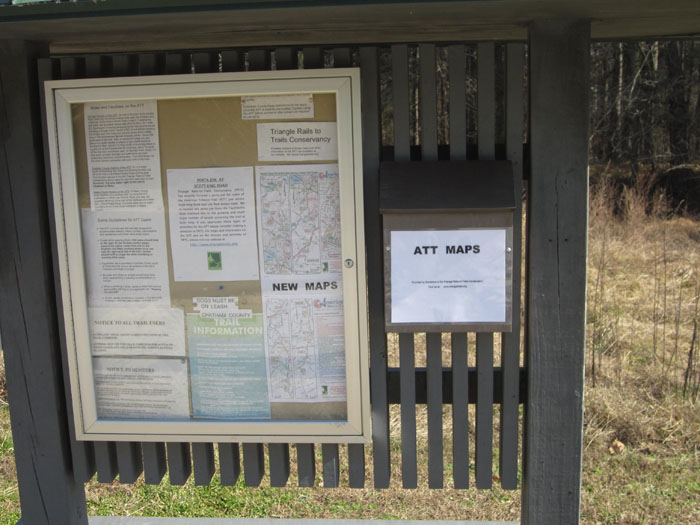
These are new, color maps (February 2019) and can be printed from these files. Click on the left map to open a large PDF version of Sections 1 and 2 plus the downtown Durham greenways and click on the right map for Sections 3 and 4 (Chatham and Wake sections, updated February 2019).
Description of Restrooms on Wake section of the ATT.
Durham’s City-County Planning Department first included the American Tobacco Trail in it’s Trails and Greenways Master Plan for 2001. To read or download the most recent Plan (2011) (946KB in the Adobe PDF format), please follow this link to the 2011 Master Plan http://www.durhamnc.gov/agendas_new/2011/cm20111205/297659_8115_422602.docx.PDF. The Greenways Plan includes system-wide and more detailed maps, goals & schedules for development, connections and constraints, and Greenway History.
User’s Guide to the ATT
Tony Reevy, a Durham resident, history buff and Board member of NC Rail-Trails has compiled a guide to the ATT. It presents mile by mile descriptions of the trail as of mid-2004. (please note that his descriptions of the Chatham County bridges and trail reflect the conditions prior to its widening and paving in 2009) His guide includes brief historical discussions of the various rail lines which ran on the corridor and notes a number of local landmarks. Several pictures of the trail are included. The Guide is available in the Portable Document Format (PDF).
ATT Mentioned in National Rail-to-Trails Publication
The ATT and TRTC were mentioned in an article in the Winter 2004 Rails to Trails magazine in an article entitled “When Bad Things Happen to Good Trails” by Kristen Kreisher Fletcher about the ice storm damage.
A June 2014 article in the Raleigh News & Observer http://www.newsobserver.com/2014/06/04/3911826_bridge-completes-american-tobacco.html?sp=/99/103/126/&rh=1 describes one user’s impressions of a ride of the entire trail and presents short capsules of sights/landmarks at several points along the trail.
Check out the American Trails Website. It’s one of the “meatiest” sites on trails that we’ve found.
Report of Crime on a Portion of the ATT
A Few Thoughts on Hunting and Use of the ATT
The ATT in Wake County, as well as the Durham County section south of Massey Chapel Road passes into and through gamelands managed by the NC Wildlife Resources Commission. Wake County Parks and TRTC are delighted to be working with both Wildlife Resources and the US Army Corps of Engineers to keep the ATT open for all trail users during hunting season.
As some of you know each Fall (Sept. throgh December) brings deer and other wildlife hunting. Licensed hunters may use the ATT to access gamelands at any time. Many hunters will choose to utilize the American Tobacco Trail to access gameland before or after trail hours of operation so most non-hunter trail users won’t see them. Hunters should be aware and follow gameland rules and regulations. You can find them at the NC Wildlife Resources website.
For those non-hunters among us, please keep in mind a few things:
- Licensed hunters are allowed to utilize the ATT to access gamelands at anytime. Hunters have the same rights as other trail users such as hikers, bicycle riders, equestrians and wheelchair users.
- No one is allowed to fire their weapon from the ATT, or fire across the ATT. No one can carry a loaded weapon on the ATT. No one may use a motorized vehicle on the ATT. Hunting is not allowed on Sunday
- That said, it is always a good idea to wear blaze orange while on the ATT during deer hunting season.
If you have any concerns about hunting or suspect violations of hunting rules, contact the NC Wildlife Resources at 1-800-662-7137 or their Enforcement Division at 919-733-7191. You can find other contact numbers at the NC Wildlife Resources website.
The New Hope Valley Railroad/The American Tobacco Trail
(Adapted from article written by Al Capehart in 1993)
The American Tobacco Trail (ATT) is a 22-mile-long rails-to-trails project located in the Research Triangle region of North Carolina. The route crosses through the City of Durham; Durham, Chatham, and Wake counties; the planning jurisdictions of the Towns of Cary and Apex; and passes through the Jordan Lake project lands of the U.S. Army Corps of Engineers.
The former railroad corridor on which the American Tobacco Trail is being built was originally developed as the New Hope Valley Railroad. This later became the Durham and South Carolina Railroad.
The Durham and South Carolina RR (D&SC) began construction in the New Hope valley in September of 1905 and was completed in October 1906. The line followed the New Hope River basin passing the communities of Seaforth, Farrington and others, until it joined the Durham and Southern RR, and again the Seaboard Air Line RR, in East Durham, using their track to reach downtown Durham. In 1920, Norfolk Southern penned a 99-year lease with the D&SC RR, and in 1957 they bought the small railroad outright.
In April 1969, the U.S. Army Corps of Engineers entered into a relocation agreement with the D&SC, with Norfolk Southern as a third party, to move the rail line from the New Hope River basin to higher ground in preparation for the building of the New Hope Dam and Reservoir, later known as Jordan Lake. The Corps spent about $250,000 to negotiate and acquire the land for the rail line and then $4,900,000 to construct the 18.5-mile railroad. The new line branched off the old one about 1000 feet south of what is now I-40 at a place called Penny, and rejoined it near Bonsal in Wake County. The line was improved with 100-pound steel rails, replacing the 70 pound steel rails used on the old line built by the Durham and South Carolina railroad. In March 1974, the transfer took place with the D&SC and Norfolk Southern getting the new steel and fee simple property from the U.S. Army Corps of Engineers. However, earlier that year, the Southern Railway and the Norfolk Southern had merged, making the D&SC line redundant. It was decided to abandon the line. The Southern Railway would later merge in 1982 with the Norfolk & Western, forming today’s Norfolk Southern Corporation.
The relocation agreement stated that before the transfer, three trains had to run over the new line to test its stability. The story goes that as the third train backed up the route, it took up the steel and ties for their salvage value. An adjacent property owner accounted that he saw only one train, which carried pulpwood – but not tobacco – ever use the corridor. Formal abandonment began in 1979. The tracks, ties, and gravel were removed in 1983, leaving a long “dirt road” that was used informally as both a recreational trail and dumping ground for area residents.
Until 1995, the majority of the railroad corridor remained under Norfolk Southern ownership, although several sections of the corridor were acquired by other business or private entities. Carolina Power and Light, now Progress/Duke Energy, had begun construction of its Shearon Harris Nuclear Power Plant directly on the DS&C railroad property, and acquired the 12 miles of rail corridor from the plant to Duncan. The NC Dept of Transportation now did not have to build an expensive railroad bridges over US Route 1 nor soon to be constructed I-40.
Also, in Durham, the developers of Woodcroft acquired the railroad property at its intersection with Woodcroft Parkway with plans for commercial development. The developer of Folkstone acquired half of the RR corridor in 1982 for $1,800 and sold it to the City of Durham for part of its Greenway in 1992 for $28,000. Some of the adjacent property owners in Wake County were able to buy back from Norfolk Southern the property they or earlier owners originally sold to the Corps. The Town of Cary purchased just over a mile of the corridor to carry their water line from Jordan Lake to their filtration plant. The East Carolina Chapter of the National Railway Historical Society purchased six and a half miles of the line from the Durham and South Carolina RR in 1983 and now operates the New Hope Valley Railway, a hobby railroad, and the N.C. Railroad Museum. Between 1995 and 1998, the remaining sections of the railroad corridor (in southern Durham, Chatham, and Wake Counties) were purchased by the NC Department of Transportation.
In April 1987, the Durham City Council, at the encouragement of the Durham Urban Trails and Greenways Commission, passed a resolution stating that all abandoned rail corridors in the City were to be incorporated into the city’s Greenway System Master Plan and were thereby protected from being developed upon. The intent was these corridors should be saved for future rail service by interim trail use. Similar action has been taken by the Durham County Commissioners.
Since the late 1980’s, the Triangle Rails-to-Trails Conservancy (TRTC), a volunteer non-profit organization, has been working to have the corridor preserved. They have advocated for the construction of the American Tobacco Trail, a shared or multi-use recreational and non-motorized transportation greenway utilizing 22 + miles of the corridor in Durham, Wake and Chatham counties. A Master Plan for the ATT was prepared in 1992. Throughout the 1990’s, property acquisition and planning continued by NCDOT, the City of Durham, Chatham and Wake counties.
As of late 2003, Durham has constructed almost eight miles of paved greenway on the former RR corridor. Wake County has constructed 3.75 miles of granite-screenings -surfaced trail open to hikers, cyclists, wheelchair users, and equestrians. Chatham County has now leased the corridor from the NCDOT and is looking for funding sources to construct its section of the trail. (Construction of Chatham’s 4.67 mile section and rebuilding of both bridges was completed in early 2010 and has been in use by the public since then).
A History of the Triangle Rails-to-Trails Conservancy Inc.
(Adapted from materials presented by Bill Bussey in 2003)
The Triangle Rails-to-Trails Conservancy Inc. (TRTC) was founded in 1989 to work with local and state government officials to preserve local abandoned railroad corridors for future transportation and other interim uses such as recreational trails.
Working within the Triangle J Council of Governments service area of Chatham, Durham, Johnson, Lee, Orange and Wake counties; TRTC, led by its first president, Jon Parker, TRTC obtained federal tax-exempt status, and identified what became its principal project, the American Tobacco Trail, a 22+mile long rail-to-trail conversion which would run on the former Norfolk & Southern railroad corridor from Durham to New Hill-Olive Chapel Road in western Wake County.
Parker, who was followed in TRTC’s presidency by John Goebel, worked along with Robert Payne, Al Capehart, Libby Searles, and Rick Burt to obtain an initial $2500 grant from the Durham Urban Trails and Greenways Commission and Wake Co. Parks to fund a Trail Conversion Master Plan for the American Tobacco Trail (ATT). This plan, developed by Greenways Incorporated, was published in October 1992 and presented a detailed roadmap of how the ATT should be developed.
In mid 1993, the first of a series of “Management Team” meetings were organized and held to bring together the many agencies, municipalities, and organizations that had a role in the development of the ATT. Tom Mappes used his presentation skills and engineering background to inspire and sell the vision of the ATT to these and other groups. Initial funding for the ATT was approved in 1995 utilizing funds from the Inter-Modal Surface Transportation Efficiency Act (ISTEA) and administered by the North Carolina Dept. of Transportation (NCDOT) Bicycle-Pedestrian Division.
Tom Mappes took the reins of TRTC in 1994, continuing regular management team meetings as the NCDOT and City of Durham purchased portions of the corridor. He worked with Durham staff to design the ATT and to plan to close the “gap” in trail plans in the vicinity of I-40. He and TRTC fought unsuccessfully to convince planning staff to widen the paved urban trail in Durham from a state standard ten feet to twelve feet. As a compromise, 2-foot gravel shoulders were instead agreed upon.
In Wake County, ATT trail promotion efforts began in 1990, when area equestrians, who were principal users of the abandoned railroad corridor at that time because there were no bridges over the streams to accommodate other user groups, recognized the recreational potential of the trail. Leslie Kennedy coordinated efforts of TRTC and the NC Horse Council to request the NC Department of Transportation to construct a tunnel under the soon-to-be-widened US Hwy 64 in western Wake County so that the future ATT would not be terminated at that point. Thanks to their efforts and others, the NCDOT agreed to build a tunnel under the highway, allowing the future trail to pass underneath.
The NCDOT purchased the future ATT corridor in Wake, and later in Chatham and southern Durham counties. With Cary and Apex announcing plans to eventually connect with the future trail, the ATT became the spine of what will become a network of over 70 miles of interconnected trails and greenways, including a part of the Circle-the-Triangle Trail envisioned by Sig Hutchinson and the Triangle Greenways Council. In late 1998 Curt Devereux brought TRTC online with support from NC Rail Trails. Rick Burt published several print newsletters, and Bill Bussey started a periodic e-newsletter that continued until ~2005.
Wake County officially started working on the ATT in 1998 with the first of a series of planning meetings. Christy Cornell, with support from Wake County Parks Director David Carter, Robert Hinson and others, organized and led these meetings of trail users – including TRTC members – and adjacent property owners which continued through 1999, resulting in a master plan for the ATT in Wake county in early 2000. The Wake County commissioners approved the ATT as a project later that year. TRTC obtained a grant for engineering and design work for the bridges in Wake and Chatham counties and partnered with Wake to utilize these funds for engineering and hydrology work as well as preliminary design of the bridges there.
The first 3.2-mile section of the American Tobacco Trail opened in Durham on June 3, 2000. TRTC President Bill Bussey and others continued to help county staff plan the ATT in Durham, Wake and Chatham counties. Chatham County developed a Master Plan for the ATT there, which was approved by the Chatham County commissioners in January 2002.
With a grant from the Durham Open Space and Trails Commission, TRTC, led by trail boss Thad Howard, started work on improving 3 miles of corridor from Massey Chapel Road to the Chatham County line so it could be safely used as an existing surface trail by the public right now before the rest of the trail is constructed. Since the opening of the C.M. Herndon Park in 2006, this section of trail has access to a trailhead parking area for hikers and cyclists.
Durham opened another 3.2 miles of ATT, plus the 1.5-mile long Riddle Road Spur in August 2002. These Durham sections of the ATT also became a designated portion of the East Coast Greenway, a planned 2600-mile long off -road “Urban Appalachian Trail” connection of existing and future greenways, which will stretch from Calais, Maine to Key West, Florida.
Wake County opened their first 3.5-mile phase of the ATT in August 2003 with a reception which included US Representative David Price, most Wake County Commissioners, and about 200 trail users and supporters. This ten-foot wide granite screenings-surfaced trail was the first portion of the ATT open to equestrians, and serves as a model for the remaining rural portions of the trail in Chatham and southern Durham counties.(A second phase extending north from Wimberly Road to New Hope Church Road was formally opened on June 4, 2005. This includes the new Trailhead parking area at White Oak Church Road and new rest room facilities at Olive-Chapel Road.)
TRTC continues to advocate for the American Tobacco Trail and other rail-trail and greenway projects throughout the Triangle. Please see our Future Trails page for information on the Timberlake Corridor.
(See other articles and our Trail Photos concerning the ATT elsewhere on this site for recent progress on construction and acquisition).


